

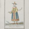
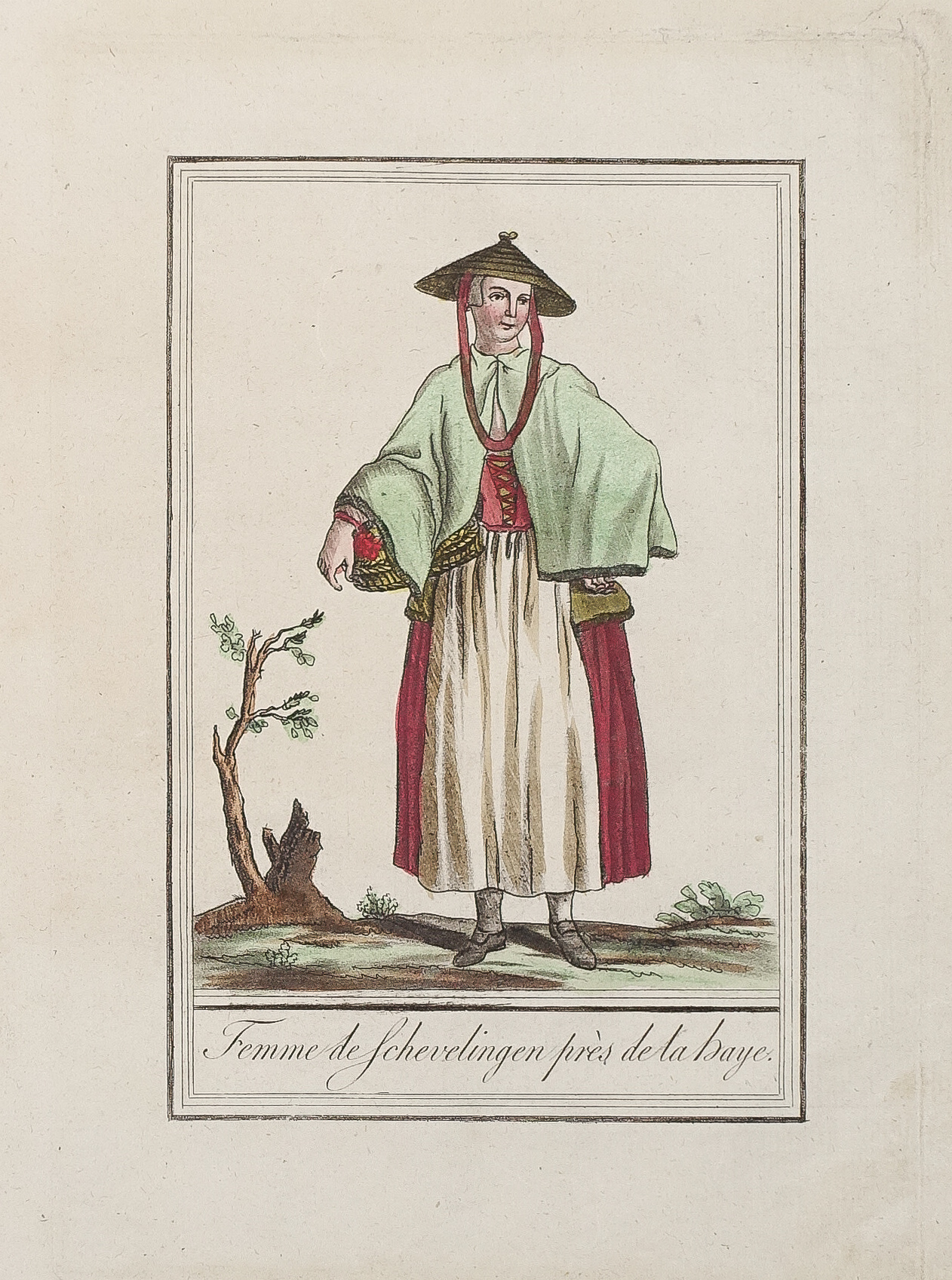
Gravure ancienne – Femme de Scheveningen
85 €
Gravure originale sur cuivre de 1796.
Beaux coloris anciens.
Format cuivre : 15 x 21 cm.
Format feuille : 19 x 24,5 cm.
Original antique engraving of 1796
1 en stock
DEMANDE D'INFORMATION
Produits similaires
Pays-Bas & Belgique & Luxembourg
Gravure originale sur cuivre de 1796. Beaux coloris anciens. Format cuivre : 15 x 21 cm. Format feuille : 19 x 24,5 cm. Original antique engraving of 1796
Pays-Bas & Belgique & Luxembourg
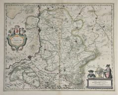
Epreuve originale réalisée en 1638. Henricus Hondius cartographe. Beaux coloris anciens. Texte latin au verso. Très bon état. Format cuivre : 49 x 39 cm. Format feuille : 54 x 45 cm. Original antique map of 1638
Pays-Bas & Belgique & Luxembourg
Carte géographique ancienne – Belgii five germaniae inferioris
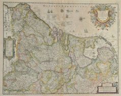
Epreuve originale réalisée en 1638. Henricus Hondius graveur. Beaux coloris anciens. Texte latin au verso. Rousseurs anciennes dans la partie centrale supérieure. Bon état. Format cuivre : 50,5 x 40 cm. Format feuille : 53 x 43,5 cm. Original antique map of 1638
Pays-Bas & Belgique & Luxembourg
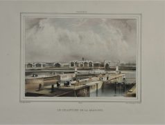
Lithographie originale réalisée vers 1860. A. Collings auteur. Coloris aquarelle. Très bon état. Format feuille : 42,5 x 29 cm. Original antique lithography around 1860
Pays-Bas & Belgique & Luxembourg
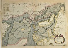
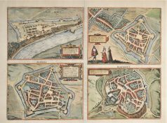
Tbula Castelli ad Sandflitam qua Simul inundati agri, alluviones, Foßae, alvei, quae Bergas ad Zomam et Antverpiam interjacent, annotantur. Epreuve originale réalisée en 1638. Johannes Janson cartographe. Beaux coloris anciens. Texte latin au verso. Rousseurs claires dans la marge inférieure et angle supérieur gauche. Format cuivre : 49,5 x 37,5 cm. Format feuille : 53 x 45 cm. Original antique map of 1638
Pays-Bas & Belgique & Luxembourg
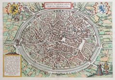
Plan original gravé en 1595. Braun et Hogenberg cartographes. Beaux coloris aquarelle. Texte explicatif en vieux français au verso. Très bon état. Format feuille : 52,5 x 38,5 cm. Format gravure : 46 x 31,5 cm. Original antique map of 1595. L’une des premières représentations de la ville. 2 blasons décoratifs dans les angles supérieurs de l’épreuve. Cartouche explicatif.
Pays-Bas & Belgique & Luxembourg
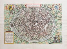
Epreuve originale réalisée vers 1580. Braun & Hogenberg cartographes. Texte latin au verso. Bon état. Format cuivre : 47,5 x 34,5 cm. Format feuille : 53,5 x 40,5 cm. Original antique map of 1580
Nord & pas de Calais
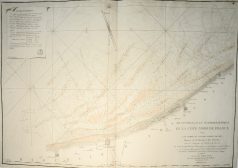
Epreuve originale réalisée en 1802 - 1803. Plages et bancs de sable rehaussés à l'aquarelle. Très bon état. Format feuille : 64,5 x 95 cm. Format gravure : 63 x 92,2 cm. Original antique map of 1802 - 1803. Large cartouche expliquant l'établissement des marées. Large boussole décorative.