

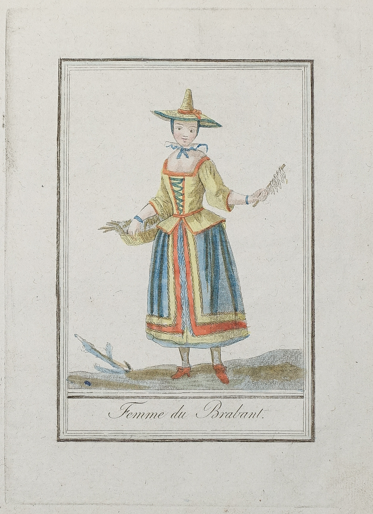
Gravure ancienne – Femme de Brabant
85 €
Gravure originale sur cuivre de 1796.
Beaux coloris anciens.
Format cuivre : 15 x 21 cm.
Format feuille : 19 x 24,5 cm.
Original antique engraving of 1796
1 en stock
DEMANDE D'INFORMATION
Produits similaires
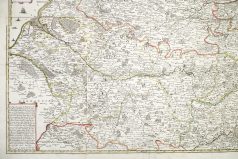
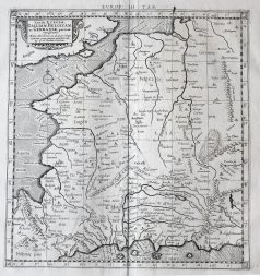
Nord & pas de Calais
Grande carte gravée en 1744. Jean Baptiste Nolin cartographe. Beaux coloris aquarelle. Limites colorées de l’époque. Quelques traces de pliures anciennes avec renforts anciens en son dos. Très bon état. Format feuille : 69,5 x 68,5 cm. Format gravure : 64,5 x 65,5 cm. Original antique map if 1744. Rare carte dédiée à Monseigneur Bignon, décorée de navires dans la partie maritime, 2 cartouches explicatifs des marques et lieux.
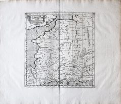
Pays-Bas & Belgique & Luxembourg
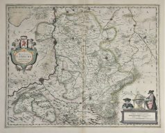
Epreuve originale réalisée en 1638. Henricus Hondius cartographe. Beaux coloris anciens. Texte latin au verso. Très bon état. Format cuivre : 49 x 39 cm. Format feuille : 54 x 45 cm. Original antique map of 1638
Pays-Bas & Belgique & Luxembourg
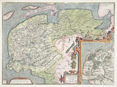
Carte originale réalisée en 1581. Abraham Ortelius cartographe. Belle impression. Coloris aquarelle. Explication de la carte en français au verso. Format feuille : 61,5 x 43,5 cm. Format cuivre : 57,5 x 37 cm. Très bon état. Original antique map of 1581. Très belle épreuve réalisée en 1579 d’après la carte manuscrite de Jon Bloemmaerts ou Johannes Florianus et représentant l'important centre d'expédition d'Emden et des îles Watten. Un large catouche décoratif montre la région inondée par la grande inondation du jour de Noël 1277. Rare édition de 1581 avec un commentaire en vieux français au dos de la carte. Rare édition de 1581 avec un commentaire en vieux français au dos de la carte.
Pays-Bas & Belgique & Luxembourg
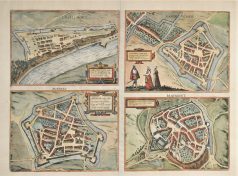
Epreuve originale réalisée vers 1610. Guicciardini auteur. Très bon état. Format feuille : 34,5 x 29 cm. Format cuivre : 31,5 x 23,5 cm. Original antique engraving around 1610
Pays-Bas & Belgique & Luxembourg
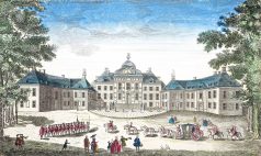
Vue du Front de la maison dans le Bois de Son Altesse Tercnissune le Prince d'Orange Stadhouder des Provinces Unies. Epreuve originale gravée vers 1750. Beaux coloris anciens. Légende manuscrite ancienne dans le haut de l’épreuve. Bon état. Format feuille : 38 x 23 cm.
Pays-Bas & Belgique & Luxembourg
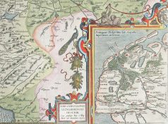
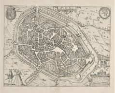
Epreuve originale réalisée vers 1580. Braun & Hogenberg cartographes. Texte latin au verso. Bon état. Format cuivre : 47,5 x 34,5 cm. Format feuille : 53,5 x 40,5 cm. Original antique map of 1580
France générale
Carte originale gravée en 1690. Anonyme. Belle épreuve sur grand papier. Très bon état. Format feuille : 64 x 54 cm. Format gravure : 55 x 40 cm. Original antique map of 1690. Belle édition réalisée à la fin du 17ème siècle par les imprimeurs hollandais d’Utrecht Strick et Halma.
Pays-Bas & Belgique & Luxembourg
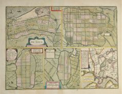
Plan ancien – De Zype – Beemster – De Purmer – De Wormer – Waterland
Epreuve originale réalisée en 1638. Henricus Hondius cartographe. Beaux coloris anciens. Texte latin au verso. Très bon état. Format cuivre : 47,5 x 35,5 cm. Format feuille : 53 x 45 cm. Original antique map of 1638