

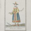
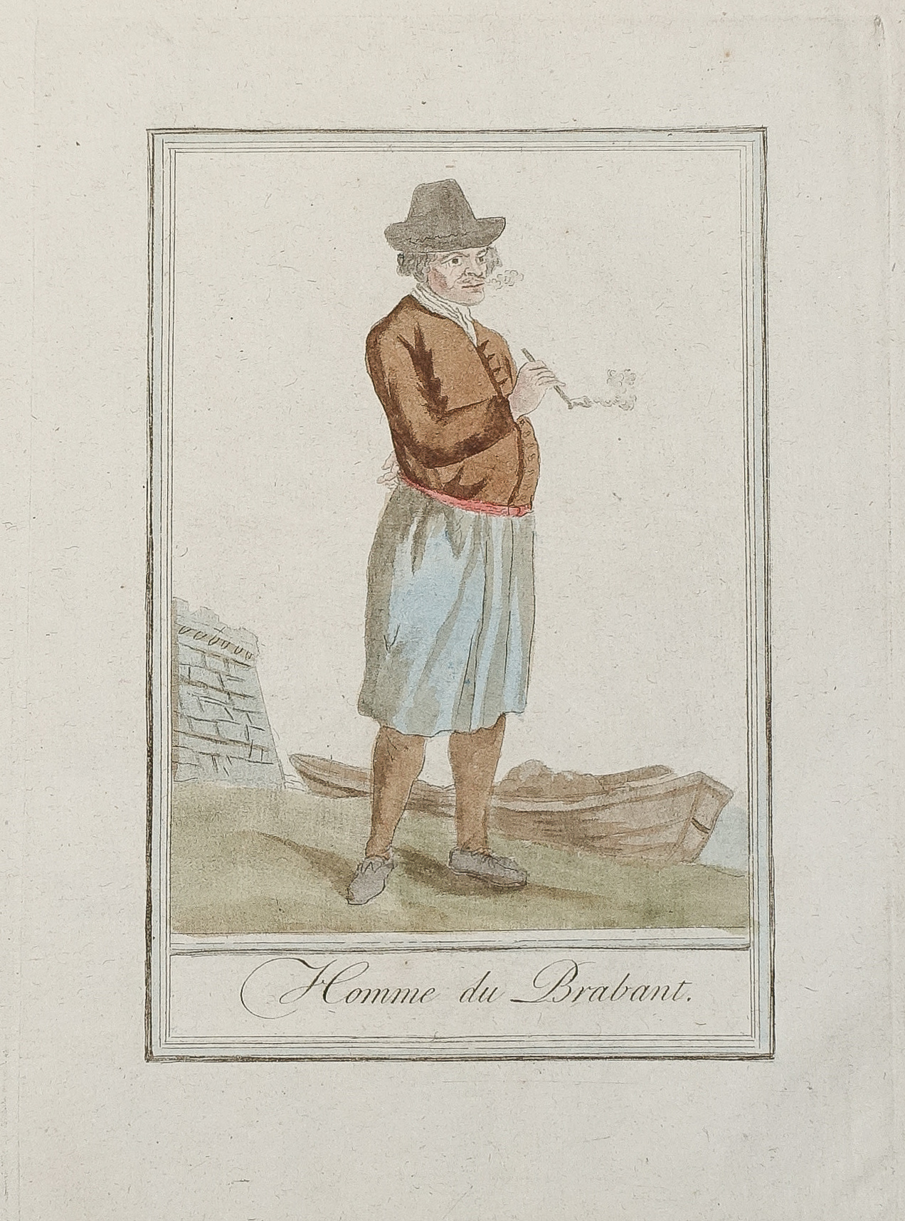
Gravure ancienne – Homme de Brabant – Original antique engraving
85 €
Gravure originale sur cuivre de 1796.
Beaux coloris anciens.
Format cuivre : 15 x 21 cm.
Format feuille : 19 x 24,5 cm.
Original antique engraving of 1796
1 en stock
DEMANDE D'INFORMATION
Produits similaires
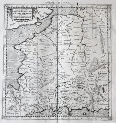
Pays-Bas & Belgique & Luxembourg
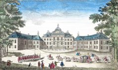
Vue du Front de la maison dans le Bois de Son Altesse Tercnissune le Prince d'Orange Stadhouder des Provinces Unies. Epreuve originale gravée vers 1750. Beaux coloris anciens. Légende manuscrite ancienne dans le haut de l’épreuve. Bon état. Format feuille : 38 x 23 cm.
France générale
Carte originale gravée en 1690. Anonyme. Belle épreuve sur grand papier. Très bon état. Format feuille : 64 x 54 cm. Format gravure : 55 x 40 cm. Original antique map of 1690. Belle édition réalisée à la fin du 17ème siècle par les imprimeurs hollandais d’Utrecht Strick et Halma.
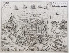
Pays-Bas & Belgique & Luxembourg
Epreuve originale réalisée en 1638. Johannes Janson cartographe. Beaux coloris anciens. Texte latin au verso. Bon état. Format cuivre : 50 x 38,5 cm. Format feuille : 52,5 x 45 cm. Original antique map of 1638
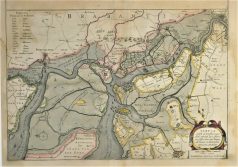
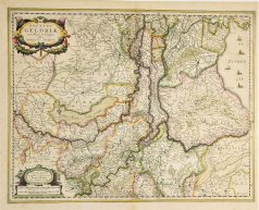
Pays-Bas & Belgique & Luxembourg
Tbula Castelli ad Sandflitam qua Simul inundati agri, alluviones, Foßae, alvei, quae Bergas ad Zomam et Antverpiam interjacent, annotantur. Epreuve originale réalisée en 1638. Johannes Janson cartographe. Beaux coloris anciens. Texte latin au verso. Rousseurs claires dans la marge inférieure et angle supérieur gauche. Format cuivre : 49,5 x 37,5 cm. Format feuille : 53 x 45 cm. Original antique map of 1638
Pays-Bas & Belgique & Luxembourg
Epreuve originale réalisée vers 1610. Guicciardini auteur. Très bon état. Format feuille : 34,5 x 29 cm. Format cuivre : 31,5 x 23,5 cm. Original antique engraving around 1610
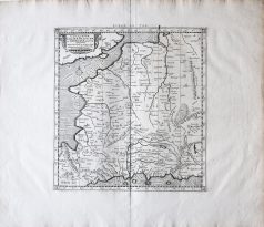
Pays-Bas & Belgique & Luxembourg
Epreuve originale réalisée vers 1610. Bon état. Format cuivre : 34 x 25 cm. Format feuille : 35 x 29,5 cm. Original antique map of 1610
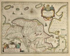
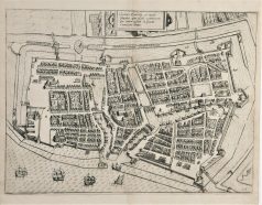
Pays-Bas & Belgique & Luxembourg
Carte originale gravée sur cuivre en 1638. Henricus Hondius cartographe. Beaux coloris anciens. Texte latin au verso. Très bon état. Format cuivre : 50,5 x 39,5 cm. Format feuille : 53 x 45 cm. Original antique map of 1638
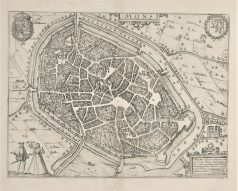
Pays-Bas & Belgique & Luxembourg
Epreuve originale réalisée en 1590. Braun & Hogenberg cartographes. Belle impression bien contrastée. Texte en français au dos. Très bon état. Format feuille : 53 x 38,5 cm. Format gravure : 46,5 x 35,5 cm. L’une des premières représentations de la ville.