

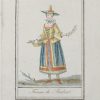
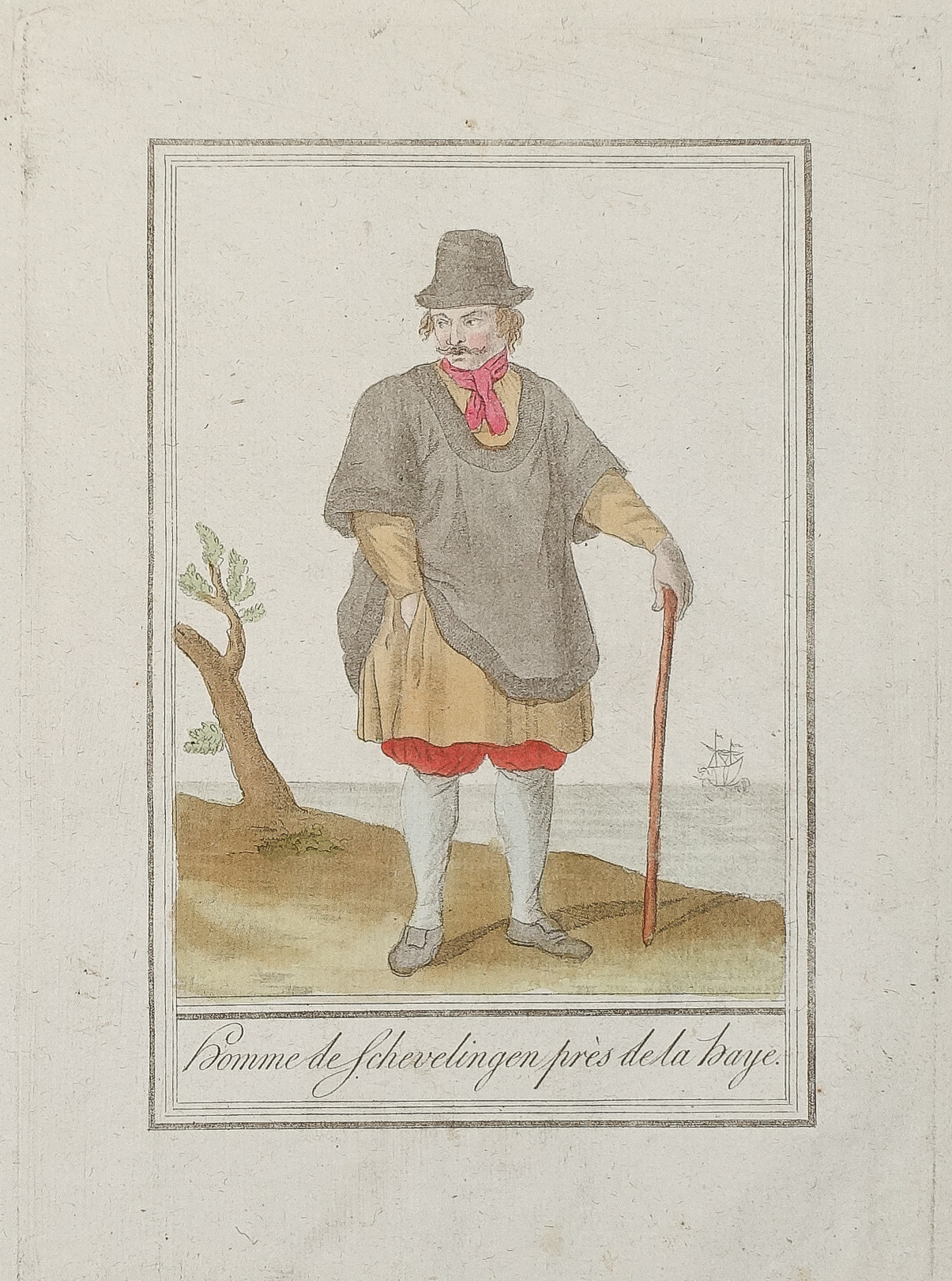
Gravure ancienne – Homme de Scheveningen
85 €
Gravure originale sur cuivre de 1796.
Beaux coloris anciens.
Format cuivre : 15 x 21 cm.
Format feuille : 19 x 24,5 cm.
Original antique engraving of 1796
1 en stock
DEMANDE D'INFORMATION
Produits similaires
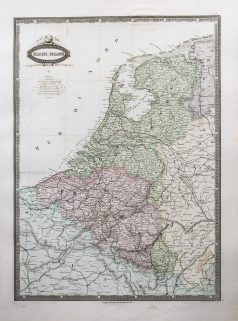
Pays-Bas & Belgique & Luxembourg
Epreuve originale réalisée au 18ème siècle. Jean François Lucas auteur. Coloris aquarelle. Très bon état. Format feuille : 57,5 x 42,5 cm. Plan historique de la ville et port d’Anvers. Renvois explicatifs dans la légende supérieure avec numérotation de 1 à 7 ; de l’année 1200 à 1701. Cartouche de titre et encart cartographié du Marquisat du Saint Empire d’Anvers.
Pays-Bas & Belgique & Luxembourg
Epreuve originale réalisée en 1638. Johannes Janson cartographe. Beaux coloris anciens. Texte latin au verso. Bon état. Format cuivre : 50 x 38,5 cm. Format feuille : 52,5 x 45 cm. Original antique map of 1638
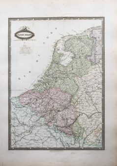
Pays-Bas & Belgique & Luxembourg
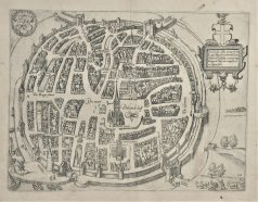
Epreuve originale réalisée vers 1610. Guicciardini auteur. Bon état. Format cuivre : 31 x 24 cm. Format feuille : 34,5 x 29 cm. Original antique map around 1610
Pays-Bas & Belgique & Luxembourg
Epreuve originale réalisée en 1638. Johannes Janson cartographe. Beaux coloris anciens. Texte latin au verso. Bon état. Format cuivre : 48,5 x 39 cm. Format feuille : 53 x 45 cm. Original antique map of 1638
Pays-Bas & Belgique & Luxembourg
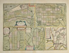
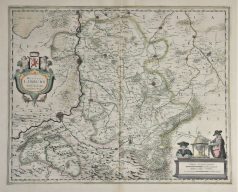
Plan ancien – De Zype – Beemster – De Purmer – De Wormer – Waterland
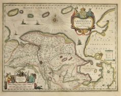
Epreuve originale réalisée en 1638. Henricus Hondius cartographe. Beaux coloris anciens. Texte latin au verso. Très bon état. Format cuivre : 47,5 x 35,5 cm. Format feuille : 53 x 45 cm. Original antique map of 1638
Pays-Bas & Belgique & Luxembourg
Turquie d’Europe. Epreuve originale réalisée en 1860. Garnier F.A cartographe. Très belle impression en couleurs. Infimes rousseurs. Très bon état. Format feuille : 61 x 42,5 cm. Format gravure : 49 x 37 cm. Original antique map of 1860. Echelle des mesures. Nouvelle géographie réalisée par le cartographe L.A Garnier en 1860, membre de la société de Géographie depuis 1850. La parfaite netteté des coloris, le choix du papier et l’exécution typographique furent unanimement salués par la communauté scientifique de l’époque. Peu courant.
Pays-Bas & Belgique & Luxembourg
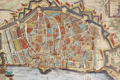
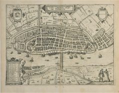
Gravure originale réalisée en 1613. Guicciardini auteur. Très bon état. Format cuivre : 32 x 23,5 cm. Format feuille : 35 x 29,5 cm. Original antique map of 1613. Renvois de 1 à 17 situant les principaux lieux de la ville.
Pays-Bas & Belgique & Luxembourg
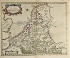
Epreuve originale réalisée en 1638. Henricus Hondius cartographe. Beaux coloris anciens. Texte latin au verso. Très bon état. Format cuivre : 49 x 39 cm. Format feuille : 54 x 45 cm. Original antique map of 1638