

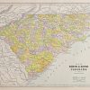
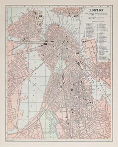
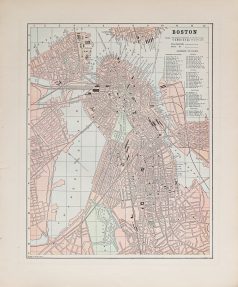
Plan ancien de Boston
85 €
Plan original de 1893.
Très bon état.
Texte explicatif du Michigan au verso.
Format feuille : 36 x 29,5 cm.
Original antique map of 1893
Rupture de stock
DEMANDE D'INFORMATION
Produits similaires
Carte originale gravée en 1870. Johnston cartographe. Belle impression en couleurs. très bon état. Format feuille : 61,5 x 48 cm. Original antique map of 1870
Etats - Unis
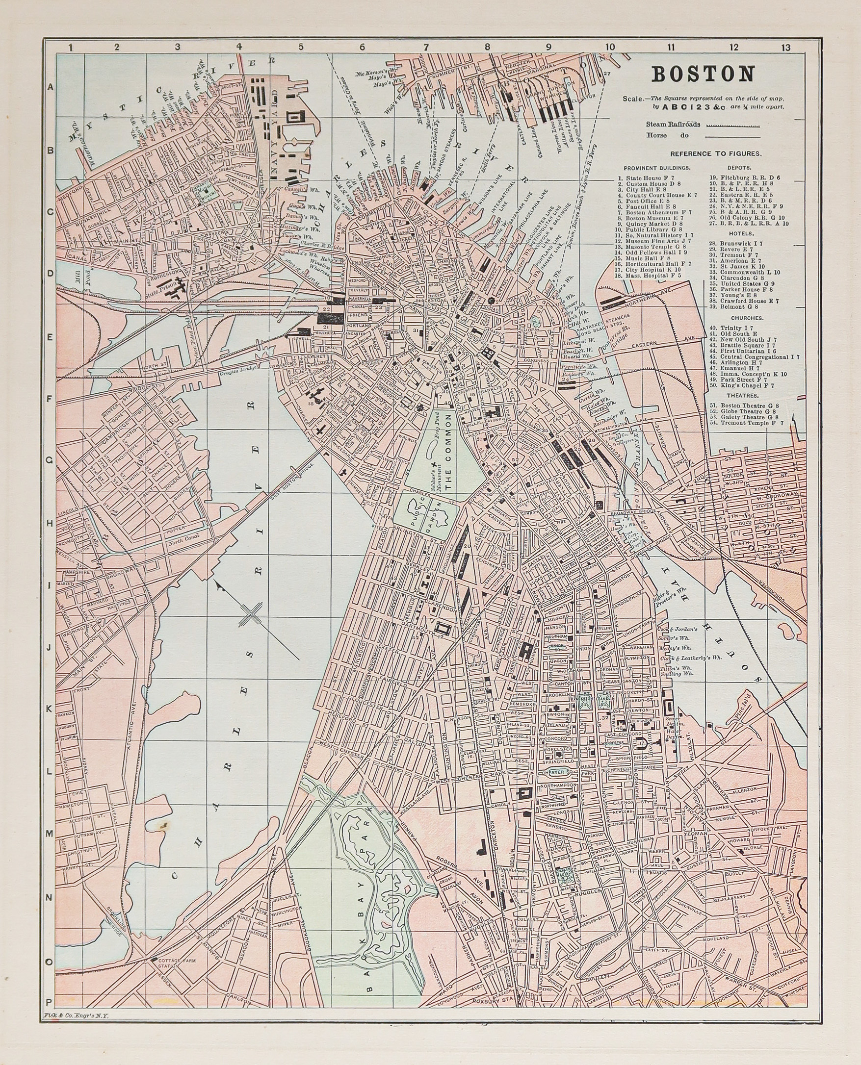
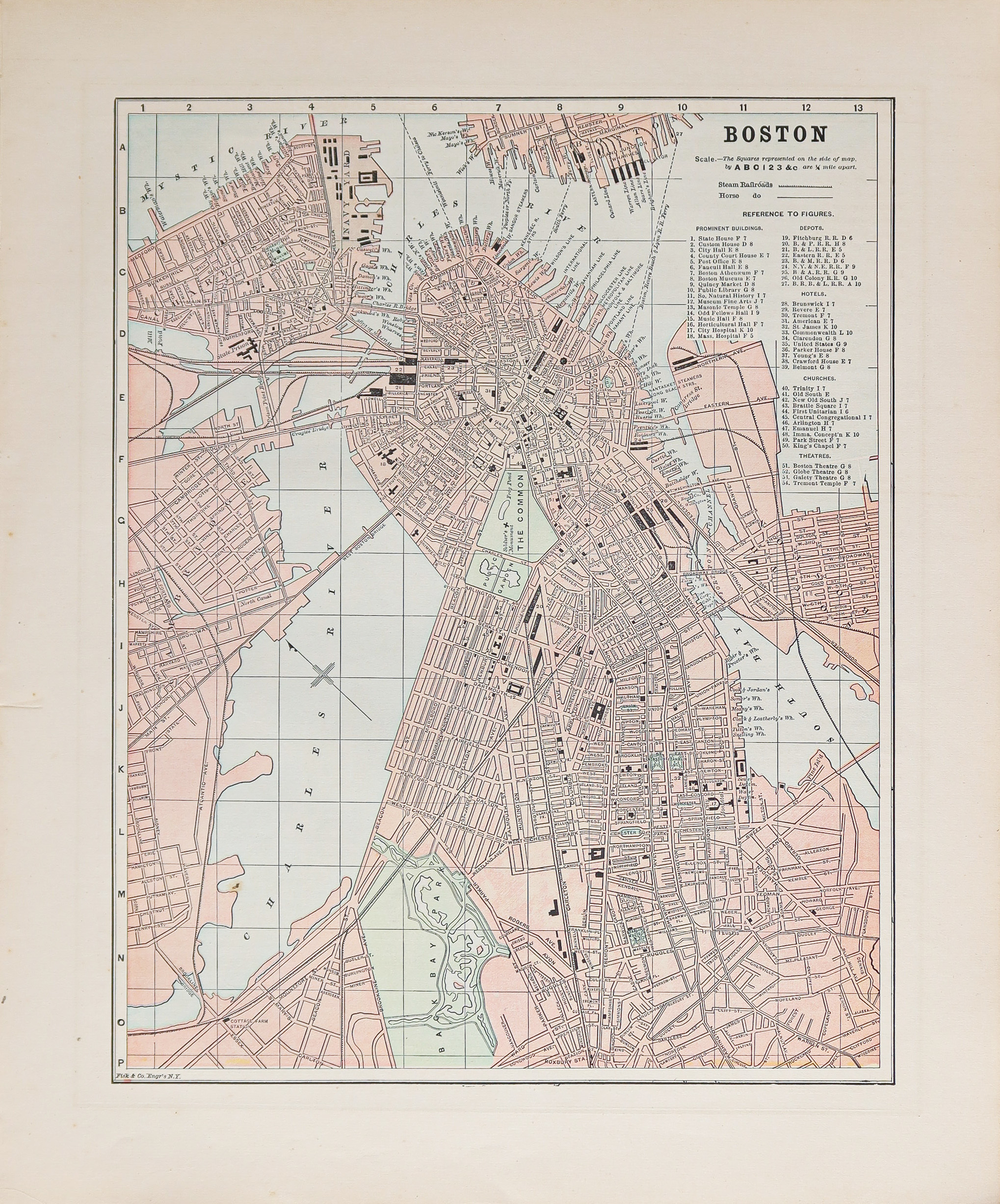
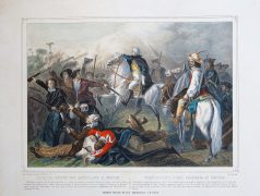
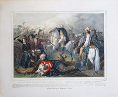
Epreuve originale réalisée en 1860. Turgis lithographe. Beaux coloris anciens. Rousseurs claires éparses. Bon état. Format feuille : 58,5 x 49,5 cm. Original antique engraving 1860. Rare représentation lithographiée des Américains à Boston. « Washington, élu général des Troupes, se fit forcé de composer son armée d’hommes ne voulant reconnaître aucune discipline, mais enthousiastes de liberté. » (L’auteur).
Amérique Centrale
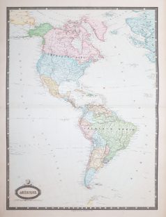
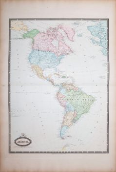
Grande épreuve originale gravée en 1860. Garnier cartographe. Belle impression en couleurs. Infimes rousseurs. Très bon état. Format feuille : 78 x 57 cm. Format gravure : 70 x 52 cm. Original antique map of 1860. Excellente carte du géographe Francis Garnier, éditée par Renouard qui utilisera pour cette édition une très large palette de coloris particulièrement harmonieuse.

Cartes Marines
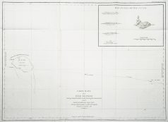
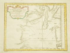
Carte originale gravée à Paris en 1797-1798. Très bon état. Format feuille : 73,5 x 56 cm. Original antique map of 1798. Carte marine montrant Necker Island, une petite île de l'océan Pacifique, qui fait partie des îles hawaïennes du nord-ouest. La Pérouse fut le premier Européen à visiter l'île, en 1786.
Amérique du Nord
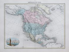
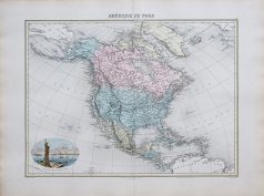
Carte originale réalisée en 1895. L. Smith graveur. Très bon état. Format feuille : 53 x 39,5 cm. Original antique map of 1895. Edition de la fin du 19ème siècle, illustrant les pays et continents, impression en couleurs des différentes régions. Cartouche aquarellé illustrant l’Entrée du Port de New-York.
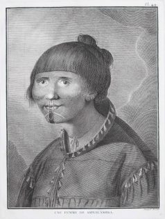
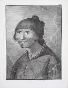
Femme de Oonalashka. Epreuve originale gravée vers 1770. Bernard dessinateur. Très bon état. Format feuille : 27 x 20 cm. Format gravure : 24 x 18 cm. Original antique engraving around 1770. Témoignage gravé du troisième voyage de Cook de 1768 à 1771.
Etats - Unis
Carte originale gravée en 1750. Bellin cartographe. Très bon état. Beaux coloris aquarelle. Format gravure : 29,5 x 22 cm. Format feuille : 37 x 25 cm. Original antique map of 1750
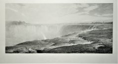
Epreuve originale de 1875. W. Forest graveur, F. Church peintre. Beau panorama en première impression sur papier japon. Format feuille : 74,5 x 51 cm. Format gravure : 63,5 x 49 cm. Original antique engraving of 1875