

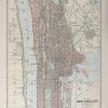
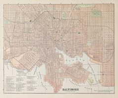
Plan ancien de New-York City – Original antique map
Plan original de 1893.
Très bon état.
Texte explicatif au verso.
Format feuille : 36 x 29,5 cm.
Original antique map of 1893
Vendu
DEMANDE D'INFORMATION
Produits similaires
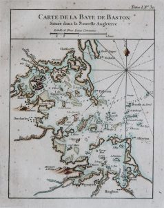
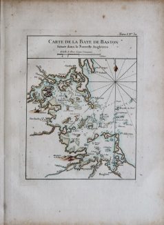
Epreuve originale de 1797. Très bon état. Format feuille : 53,5 x 40,5 cm. Format gravure : 50 x 34,5 cm. Original antique map of 1797
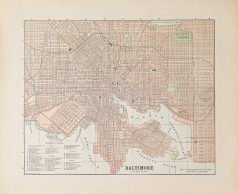
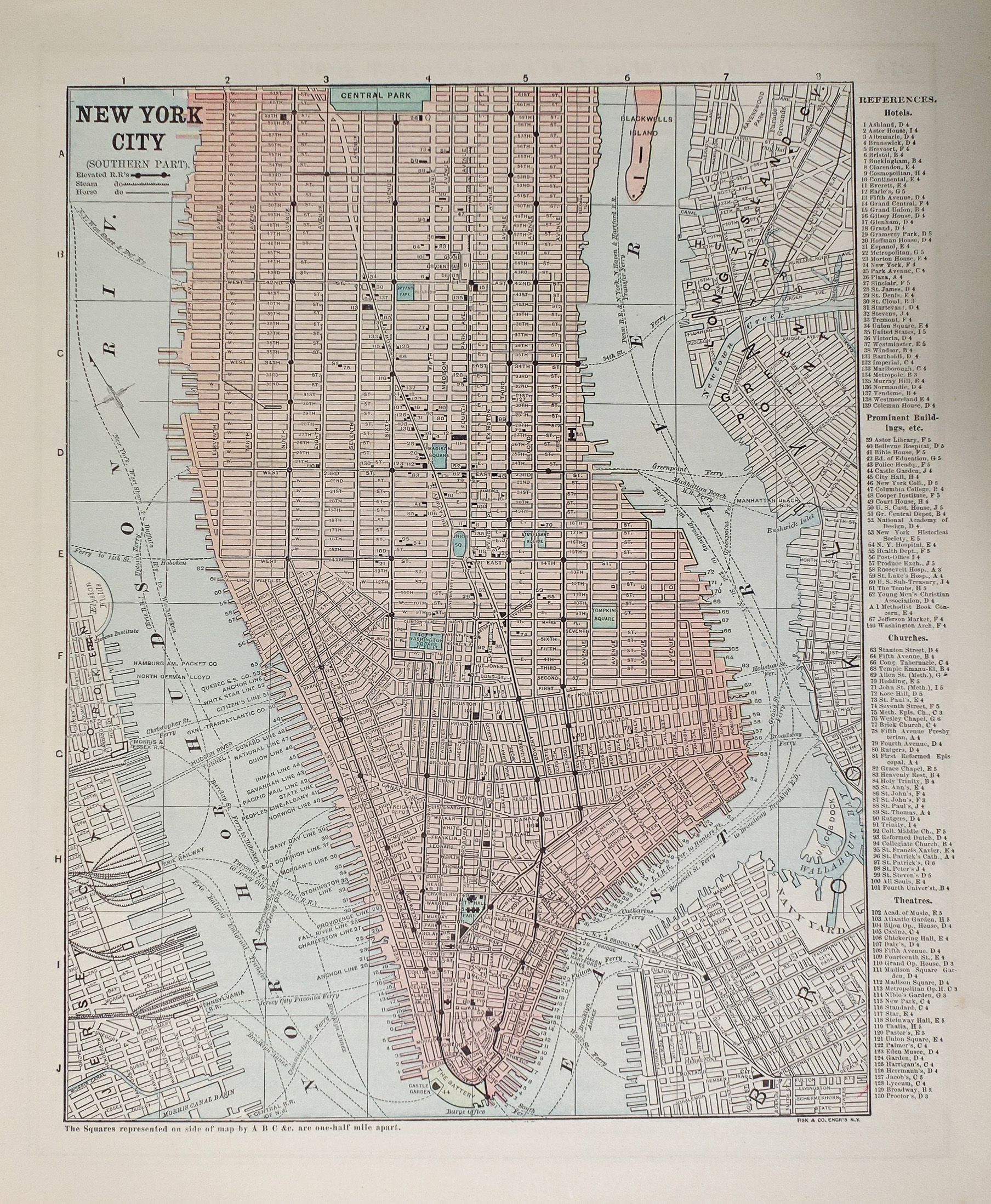
Etats - Unis
Plan original de 1893. Très bon état. Texte explicatif de Washington au verso. Format feuille : 36 x 29,5 cm. Original antique map of 1893
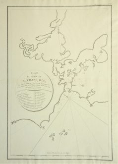
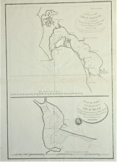
Plan ancien du Port de St François. Epreuve originale réalisée en 1797. Infimes rousseurs dans le pli central. Bon état. Format feuille : 53,5 x 40,5 cm. Format gravure : 48 x 32 cm. Original antique map of 1797. L'une des première représentation de la baie de San Francisco.
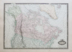
Etats - Unis
Epreuve originale réalisée en 1860. Garnier F.A cartographe. Très belle impression en couleurs. Infimes rousseurs. Très bon état. Format feuille : 61 x 42,5 cm. Format gravure : 49 x 37 cm. Original antique map of 1860. Carte illustrée d’un cartouche de St. Pierre et Miquelon. Echelle des mesures. Nouvelle géographie réalisée par le cartographe L.A Garnier en 1860, membre de la société de Géographie depuis 1850. La parfaite netteté des coloris, le choix du papier et l’exécution typographique furent unanimement salués par la communauté scientifique de l’époque. Peu courant.

Epreuve originale réalisée en 1860. Garnier F.A cartographe. Très belle impression en couleurs. Très bon état. Format feuille : 61 x 42,5 cm. Format gravure : 49 x 37 cm. Original antique map of 1860. Echelle des mesures. Excellent travail cartographique de L.A Garnier, en 1860, membre de la société de Géographie depuis 1850. La parfaite netteté des coloris, le choix du papier et l’exécution typographique furent unanimement salués par la communauté scientifique de l’époque. Peu courant.
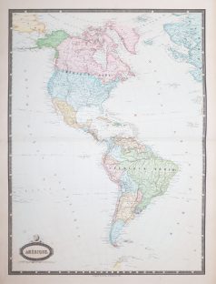
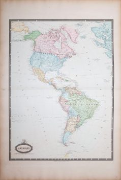
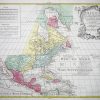
Amérique Centrale
Grande épreuve originale gravée en 1860. Garnier cartographe. Belle impression en couleurs. Infimes rousseurs. Très bon état. Format feuille : 78 x 57 cm. Format gravure : 70 x 52 cm. Original antique map of 1860. Excellente carte du géographe Francis Garnier, éditée par Renouard qui utilisera pour cette édition une très large palette de coloris particulièrement harmonieuse.
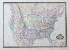
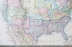
Etats - Unis
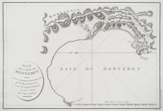
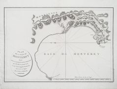
Plan original gravé à Paris en 1797-98. Petite restauration d’un trou de ver dans la partie inférieure de l’épreuve. Très bon état. Format : 53 x 40,5 cm. Original antique plan of 1798
Etats - Unis
Epreuve originale réalisée en 1764. Bellin cartographe. Coloris aquarelle. Fines rousseurs éparses. Bon état. Format feuille : 33,5 x 24,5 cm. Format gravure : 23 x 18 cm. Original antique map of 1764. Carte particulièrement précise avec relevés des fonds marins, cartouche de titre aquarellé. Repère indiquant le nord.