

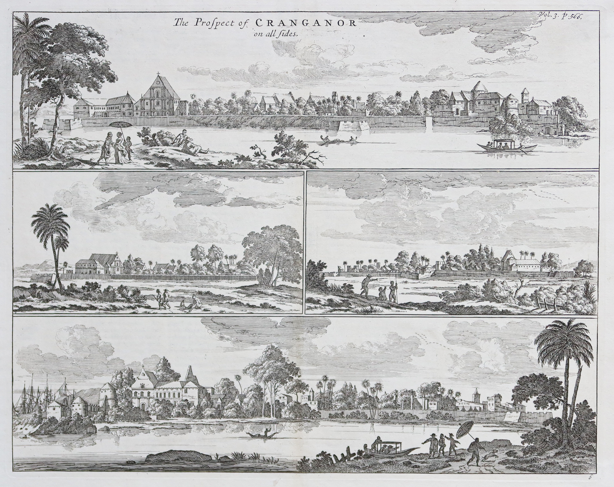
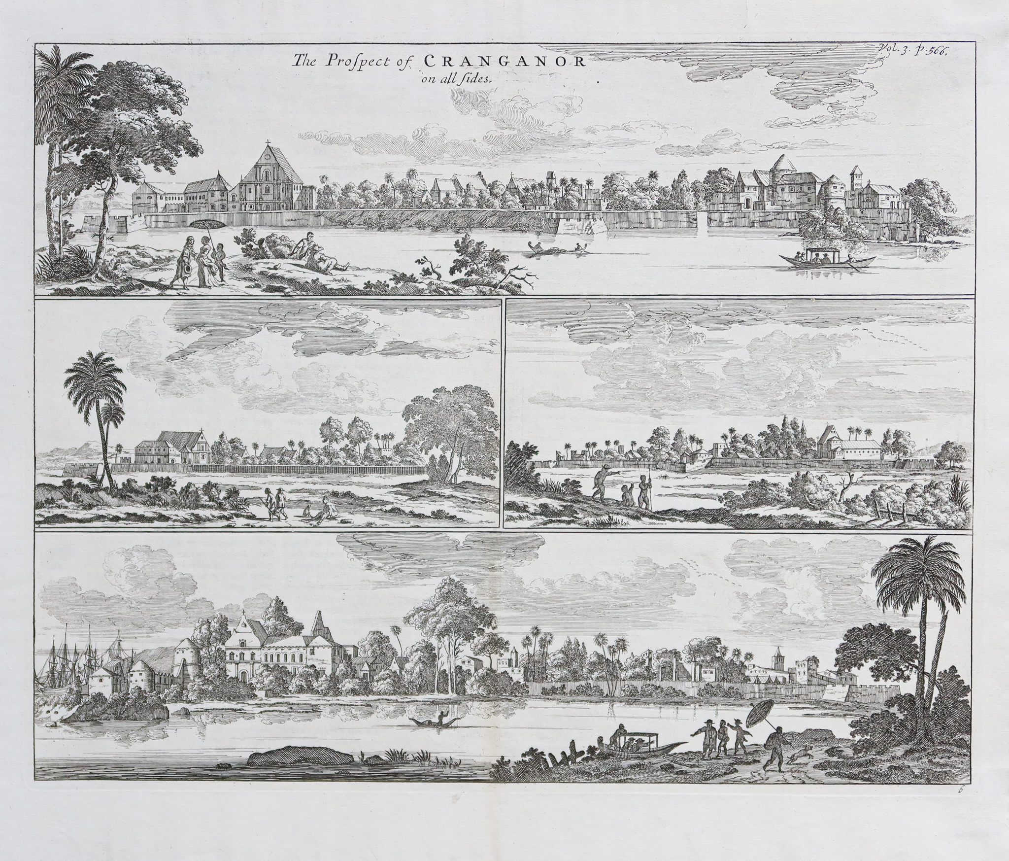
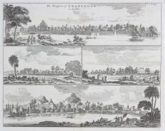
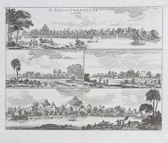
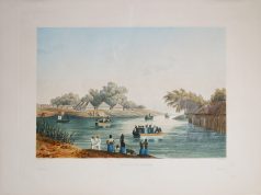
Gravure ancienne de la ville de Cranganore
125 €
The prospect of Cranganor.
Epreuve originale réalisée au 18ème siècle. Anonyme.
Très bon état.
Format feuille : 38 x 33 cm.
Format gravure : 36 x 28,5 cm.
Original antique engraving of the 18th century
1 en stock
DEMANDE D'INFORMATION
Produits similaires
Inde & Pakistan
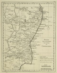
Théâtre de la Guerre sur la côte de Coromandel. Epreuve originale réalisée vers 1760. Nicolas Bellin cartographe. Très bon état. Format cuivre : 32 x 24,5 cm. Original antique map of 1760
Inde & Pakistan
Aquatinte gravée en couleurs en 1832. Himely graveur. Epreuve originale d’un tirage de 300 exemplaires gravés en couleurs. Parfait état. Original antique engraving of 1832 Rare épreuve de l’édition en couleurs du voyage de la frégate La Favorite autour du monde, réalisé par le capitaine Cyrille Laplace en 1830.
Inde & Pakistan
Epreuve originale réalisée en 1826. Limites colorées de l’époque. Excellent état Format feuille : 51 x 41 cm. Peu courante publication réalisée sous le règne de Charles X, illustrant les départements du royaume de France. Carte très soigneusement aquarellée à l’époque, instruisant avec beaucoup de précision l’histoire du département. Sa situation géographique, l’historique des principales villes, les statistiques du moment, sur la population, l’industrie et l’administration.
Inde & Pakistan
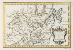
Carte gravée en 1750. Jacques-Nicolas Bellin cartographe. Coloris aquarelle. Cartouche décoratif. Excellent état. Format feuille : 38,5 x 28 cm. Format gravure : 32 x 23 cm. Original antique map of 1710
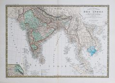
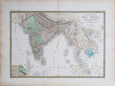
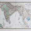
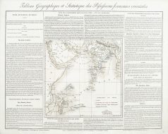
Epreuve originale réalisée en 1875. A. Brué dessinateur et géographe & E. Levasseur. Rousseurs fines dans bas du pli central. Bon état. Format feuille : 61,5 x 47,5 cm. Original antique map of 1875. Carte particulièrement détaillées avec renvois colorés indiquant les possessions occidentales, états indépendants, cartouche complémentaire du Pendjab et du Cachemire.
Inde & Pakistan
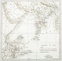
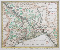
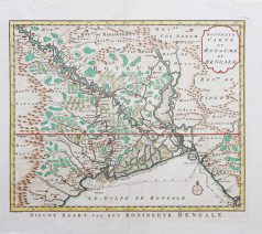
Nouvelle carte du Royaume du Bengale. Epreuve originale réalisée vers 1750. Bellin cartographe. Beaux coloris aquarelle. 2 petits trous de ver restaurés dans le haut de la carte. Bon état. Format feuille : 39,5 x 34,5 cm. Format gravure : 36,5 x 30 cm. Original antique map of 1750
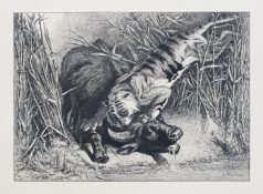
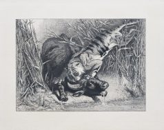
Animaux
Epreuve originale réalisée vers 1880. E. Pirodon graveur. Très bon état. Epreuve gravée à l’eau-forte en premier tirage avant la lettre imprimée sur papier japon. Tiré à part, montée sur carton bristol de l’éditeur. Format feuille : 33,5 x 27 cm. Format gravure : 32 x 23,5 cm. Original antique engraving around 1880
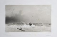
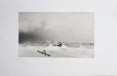
Inde & Pakistan
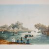
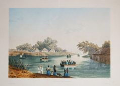
Vue de Pondichéry. Lithographie originale de 1836. Lauvergne dessinateur, Tirpenne et Lauvergne lithographes. Quelques rousseurs éparses. Bon état. Format feuille : 44 x 32 cm. Format sujet : 32 x 23 cm. Original antique lithography of 1836