

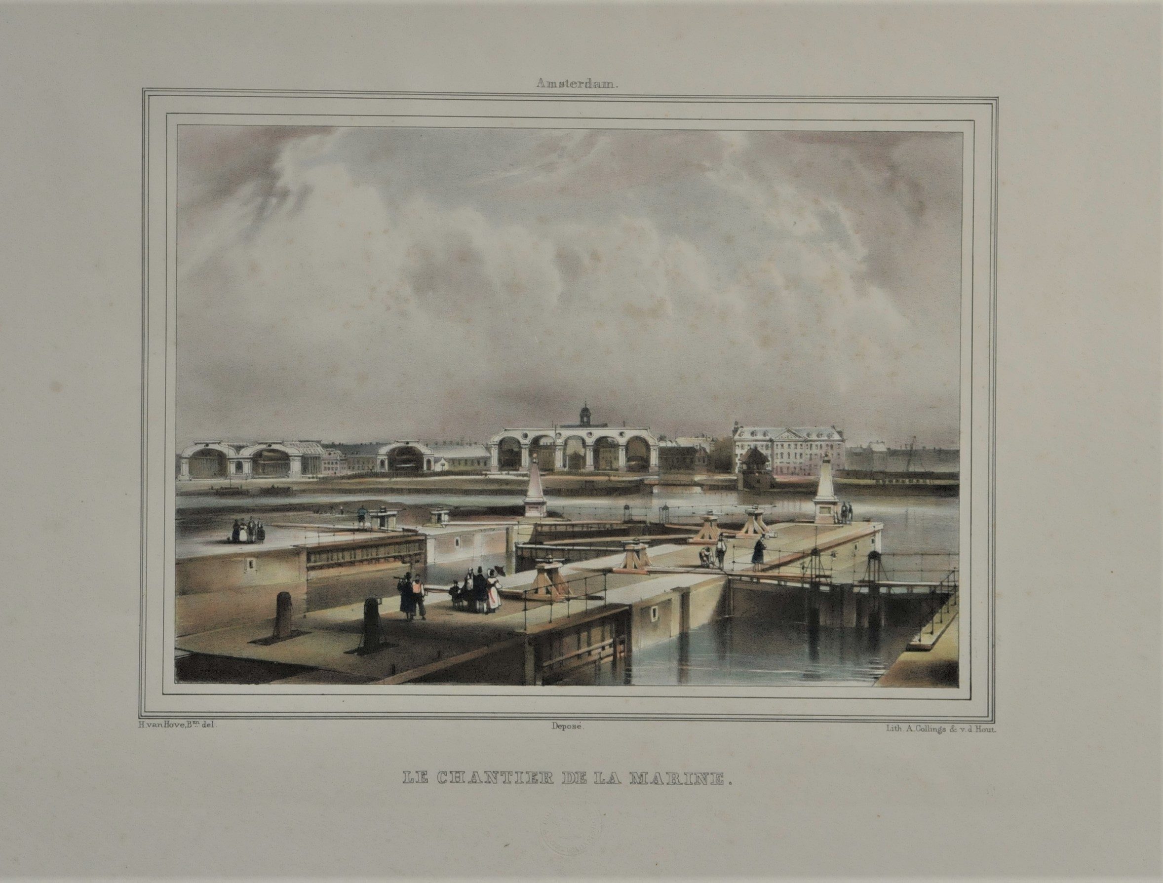
Gravure ancienne d’Amsterdam
95 €
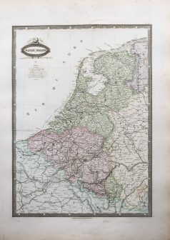
Lithographie originale réalisée vers 1860. A. Collings auteur.
Coloris aquarelle.
Très bon état.
Format feuille : 42,5 x 29 cm.
Original antique lithography around 1860
1 en stock
DEMANDE D'INFORMATION
Produits similaires
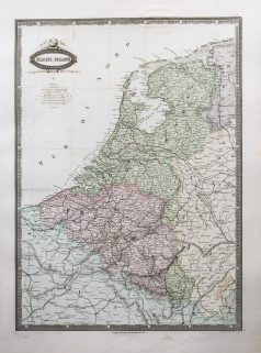
Pays-Bas & Belgique & Luxembourg
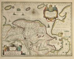
Epreuve originale réalisée en 1638. Johannes Janson cartographe. Beaux coloris anciens. Texte latin au verso. Bon état. Format cuivre : 50 x 38,5 cm. Format feuille : 52,5 x 45 cm. Original antique map of 1638
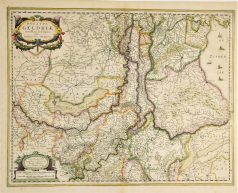
Pays-Bas & Belgique & Luxembourg
Carte originale gravée sur cuivre en 1638. Henricus Hondius cartographe. Beaux coloris anciens. Texte latin au verso. Très bon état. Format cuivre : 50,5 x 39,5 cm. Format feuille : 53 x 45 cm. Original antique map of 1638
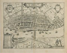
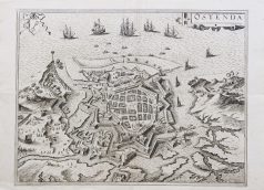
Pays-Bas & Belgique & Luxembourg
Gravure originale réalisée en 1613. Guicciardini auteur. Très bon état. Format cuivre : 32 x 23,5 cm. Format feuille : 35 x 29,5 cm. Original antique map of 1613. Renvois de 1 à 17 situant les principaux lieux de la ville.
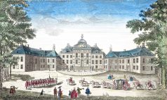
Pays-Bas & Belgique & Luxembourg
Vue du Front de la maison dans le Bois de Son Altesse Tercnissune le Prince d'Orange Stadhouder des Provinces Unies. Epreuve originale gravée vers 1750. Beaux coloris anciens. Légende manuscrite ancienne dans le haut de l’épreuve. Bon état. Format feuille : 38 x 23 cm.
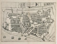
Pays-Bas & Belgique & Luxembourg
Epreuve originale réalisée vers 1610. Bon état. Format cuivre : 34 x 25 cm. Format feuille : 35 x 29,5 cm. Original antique map of 1610
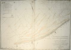
Nord & pas de Calais
Epreuve originale réalisée en 1802 - 1803. Plages et bancs de sable rehaussés à l'aquarelle. Très bon état. Format feuille : 64,5 x 95 cm. Format gravure : 63 x 92,2 cm. Original antique map of 1802 - 1803. Large cartouche expliquant l'établissement des marées. Large boussole décorative.
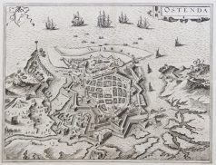
Pays-Bas & Belgique & Luxembourg
Epreuve originale réalisée en 1590. Braun & Hogenberg cartographes. Belle impression bien contrastée. Texte en français au dos. Très bon état. Format feuille : 53 x 38,5 cm. Format gravure : 46,5 x 35,5 cm. L’une des premières représentations de la ville.
Pays-Bas & Belgique & Luxembourg
Turquie d’Europe. Epreuve originale réalisée en 1860. Garnier F.A cartographe. Très belle impression en couleurs. Infimes rousseurs. Très bon état. Format feuille : 61 x 42,5 cm. Format gravure : 49 x 37 cm. Original antique map of 1860. Echelle des mesures. Nouvelle géographie réalisée par le cartographe L.A Garnier en 1860, membre de la société de Géographie depuis 1850. La parfaite netteté des coloris, le choix du papier et l’exécution typographique furent unanimement salués par la communauté scientifique de l’époque. Peu courant.