

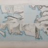
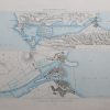

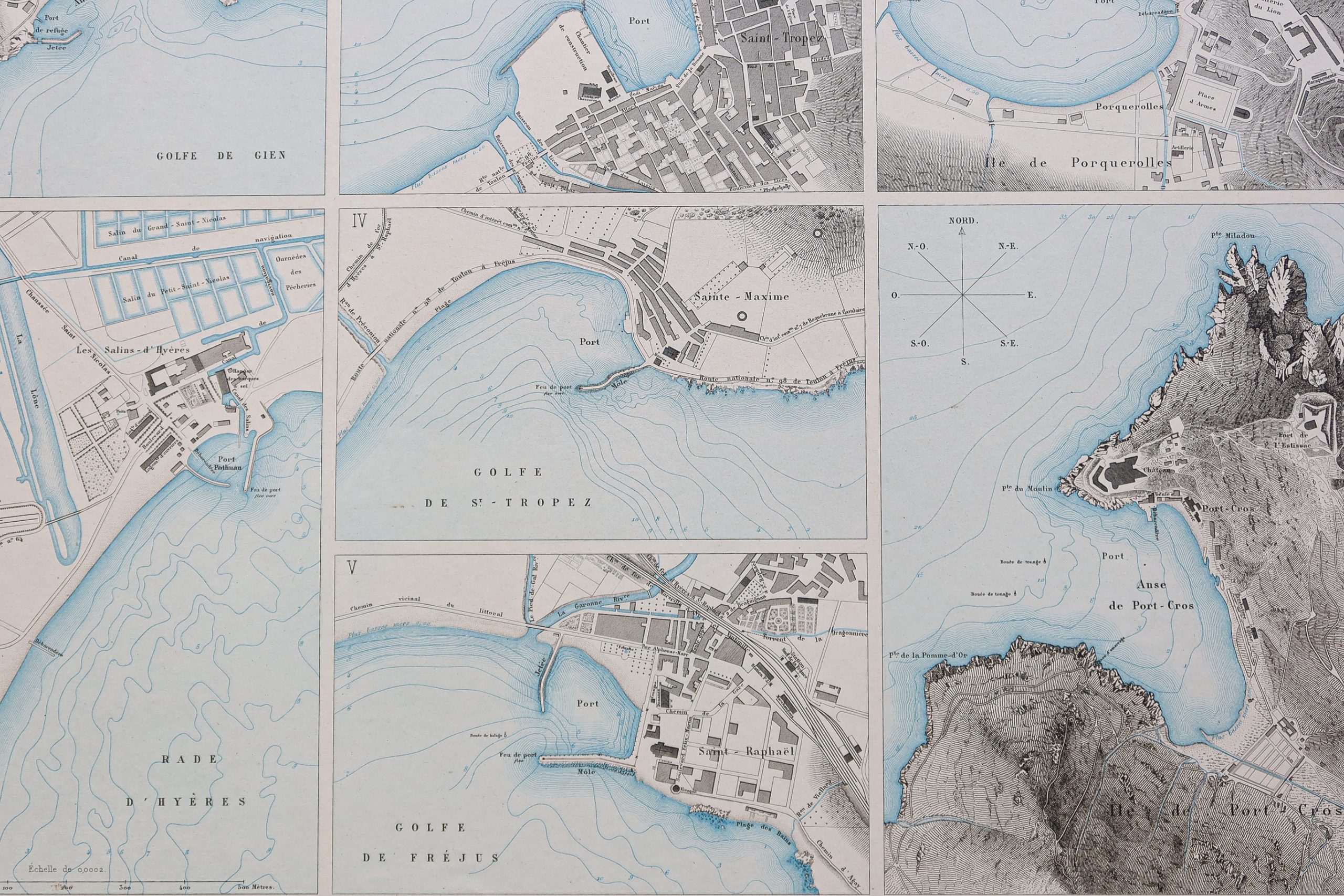
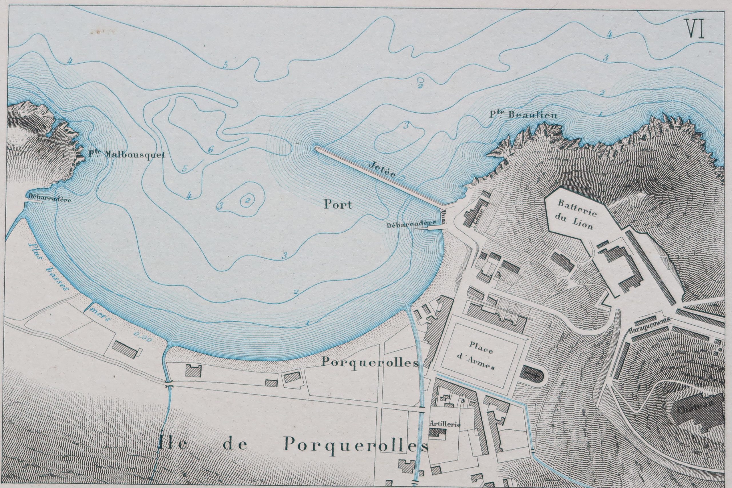
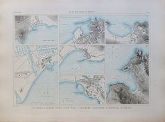
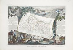
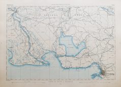
Carte marine ancienne de Saint-Tropez
200 €
Les Salettes, les Salins d’Hyères, Saint-Tropez, Sainte Maxime, Saint-Raphaël, Porquerolles, Port Cros.
Carte gravée en 1891.
Belle impression en couleurs.
Très bon état.
Format feuille : 66 x 49,5 cm.
Original antique chart of 1891.
Rare collection illustrant les ports de France.
Institution qui modèle le littoral français (1667 – 2000), dans la tradition des Neptune français.
1 en stock
DEMANDE D'INFORMATION
Produits similaires

Provence & Côte d'Azur
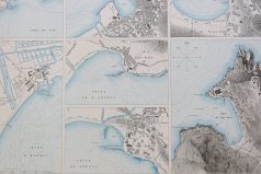
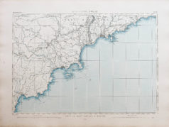
Sanary, le Gros-Saint-Georges, la Seyne. Carte gravée en 1893. Belle impression en couleurs. Petites rousseurs fines dans la marge. Bon état. Format feuille : 61,5 x 43,5 cm. Original antique chart of 1893. Rare collection illustrant les ports de France. Institution qui modèle le littoral français (1667 – 2000), dans la tradition des Neptune français.
Provence & Côte d'Azur
Carte originale gravée en 1860. Beaux coloris aquarelle. Très bon état. Format feuille : 53 x 36,5 cm. Célèbre édition du milieu du 19ème siècle publiée rue Saint Jacques à Paris, illustrée de commentaires sur les divisions administratives, curiosités, production, commerce et célébrités.
Provence & Côte d'Azur
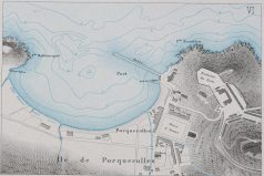
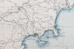
Carte gravée en 1895. Belle impression en couleurs. Très bon état. Format feuille : 65 x 47,5 cm. Original antique chart of 1895. Rare collection illustrant les ports de France. Institution qui modèle le littoral français (1667 – 2000), dans la tradition des Neptune français.
Provence & Côte d'Azur
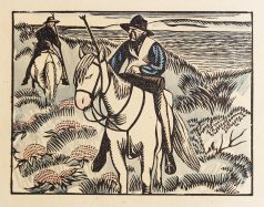
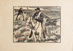
Epreuve originale gravée vers 1920. Hermann Paul graveur. Coloris aquarelle. Très bon état. Format feuille : 38,5 x 26 cm. Original antique print around 1920

Provence & Côte d'Azur
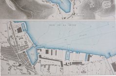
Carte gravée en 1895. Belle impression en couleurs. Très bon état. Format feuille : 63 x 46 cm. Original antique chart of 1895. Rare collection illustrant les ports de France. Institution qui modèle le littoral français (1667 – 2000), dans la tradition des Neptune français.
Provence & Côte d'Azur
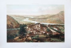
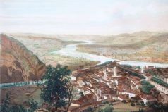
Grande lithographie originale réalisée en 1850. Guesdon Dessinateur & Springer lithographe. Beaux coloris aquarelle. Très bon état. Format feuille : 57 x 40 cm. Original antique lithography of 1850. Rare lithographie de cette collection réalisée au milieu du 19ème siècle, montrant les villes françaises en prise de vue aérienne à bord de Ballon dirigeable.
Provence & Côte d'Azur
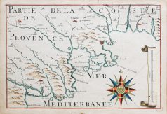
Epreuve originale réalisée en 1690. Nicolas de Fer éditeur. Beaux coloris aquarelle. Petite rousseur dans le centre de la marge inférieure, très loin de la carte. Très bon état. Format feuille : 35 x 24,5 cm. Carte particulièrement décorative ornée d’une large boussole, de galions et d’une échelle des mesures en lieues. Dans ces cartes sont marquées les côtes avec les dunes, les montagnes, caps et pointes, rades ou ancrages représentés par des petites ancres. D’après le travail de Tassin géographe, en 1635.
Provence & Côte d'Azur
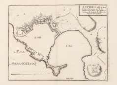
Épreuve originale réalisée en 1750. Nicolas de Fer cartographe. Très bon état. Format feuille : 31,2 x 23,7 cm. Format gravure : 23 x 17,5 cm. Original antique map of 1750