

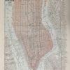
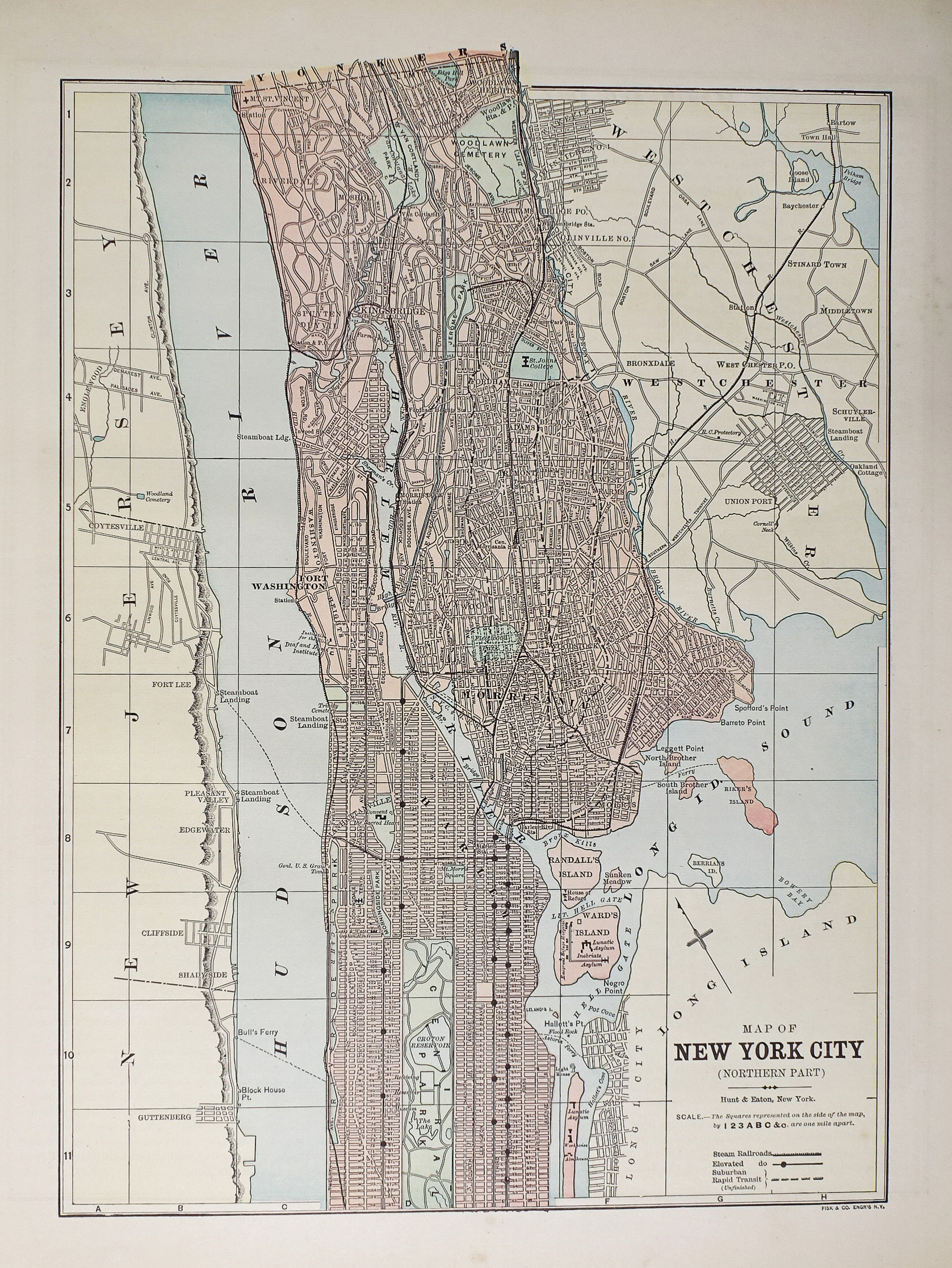
Plan ancien des Etats-Unis – New-York City – Original antique map
Plan original de 1893.
Très bon état.
Texte explicatif au verso.
Format feuille : 36 x 29,5 cm.
Original antique map of 1893
Sold
DEMANDE D'INFORMATION
Produits similaires
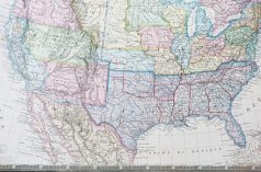
Etats - Unis
Epreuve originale réalisée en 1860. Garnier F.A cartographe. Très belle impression en couleurs. Infimes rousseurs. Très bon état. Format feuille : 61 x 42,5 cm. Format gravure : 49 x 37 cm. Original antique map of 1860. Carte illustrée d’un cartouche de St. Pierre et Miquelon. Echelle des mesures. Nouvelle géographie réalisée par le cartographe L.A Garnier en 1860, membre de la société de Géographie depuis 1850. La parfaite netteté des coloris, le choix du papier et l’exécution typographique furent unanimement salués par la communauté scientifique de l’époque. Peu courant.
Etats - Unis
Epreuve originale de 1865. Très bon état. Format feuille : 36,5 x 28 cm. Format gravure : 29 x 23 cm. Original antique engraving of 1865
Etats - Unis
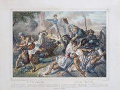
Epreuve originale réalisée en 1860. Turgis lithographe. Restauration ancienne au niveau de Washington. Beaux coloris anciens. Rousseurs claires éparses. 1 restauration ancienne dans la partie supérieure. Etat correct. Format feuille : 58,5 x 49,5 cm. Original antique engraving 1860. Rare représentation lithographiée des indiens d’Amérique. « Washington, voulant couvrir Philadelphie, se retira sur la rive droite de la Delaware dans de fortes positions où les Anglais se purent le suivre… » (L’auteur).
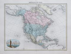
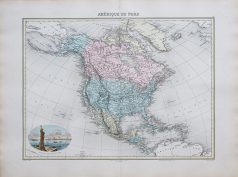
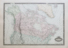
Amérique du Nord
Carte originale réalisée en 1895. L. Smith graveur. Très bon état. Format feuille : 53 x 39,5 cm. Original antique map of 1895. Edition de la fin du 19ème siècle, illustrant les pays et continents, impression en couleurs des différentes régions. Cartouche aquarellé illustrant l’Entrée du Port de New-York.
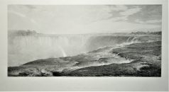
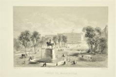
Epreuve originale de 1875. W. Forest graveur, F. Church peintre. Beau panorama en première impression sur papier japon. Format feuille : 74,5 x 51 cm. Format gravure : 63,5 x 49 cm. Original antique engraving of 1875
Etats - Unis
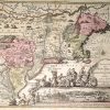
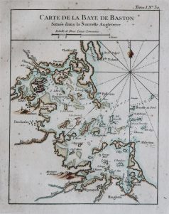
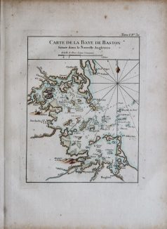
Epreuve originale réalisée en 1764. Bellin cartographe. Coloris aquarelle. Fines rousseurs éparses. Bon état. Format feuille : 33,5 x 24,5 cm. Format gravure : 23 x 18 cm. Original antique map of 1764. Carte particulièrement précise avec relevés des fonds marins, cartouche de titre aquarellé. Repère indiquant le nord.

Epreuve originale réalisée en 1860. Garnier F.A cartographe. Très belle impression en couleurs. Très bon état. Format feuille : 61 x 42,5 cm. Format gravure : 49 x 37 cm. Original antique map of 1860. Echelle des mesures. Excellent travail cartographique de L.A Garnier, en 1860, membre de la société de Géographie depuis 1850. La parfaite netteté des coloris, le choix du papier et l’exécution typographique furent unanimement salués par la communauté scientifique de l’époque. Peu courant.
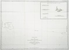

Cartes Marines
Carte originale gravée à Paris en 1797-1798. Très bon état. Format feuille : 73,5 x 56 cm. Original antique map of 1798. Carte marine montrant Necker Island, une petite île de l'océan Pacifique, qui fait partie des îles hawaïennes du nord-ouest. La Pérouse fut le premier Européen à visiter l'île, en 1786.